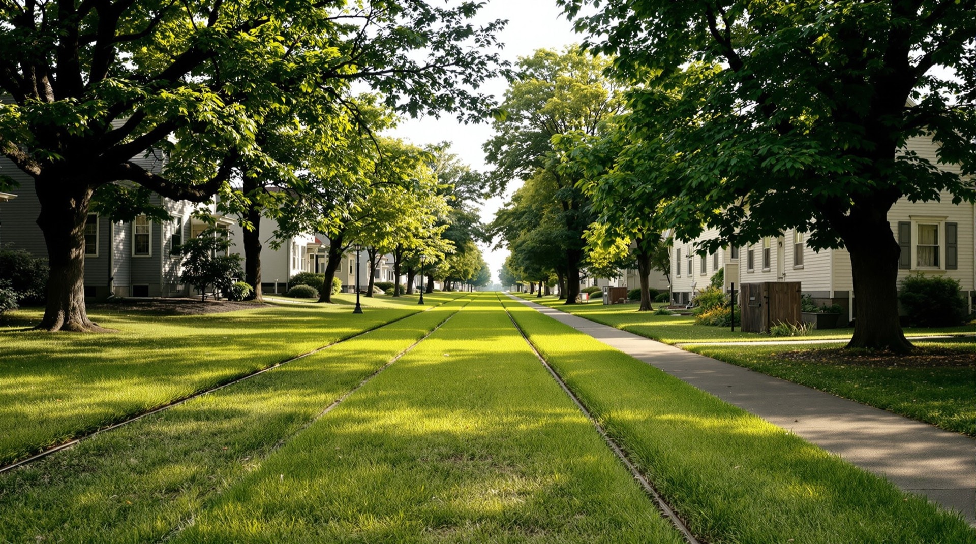
Before the automobile, much of New York moved by electric railway. Trolley and interurban lines radiated from nearly every city, running down main streets, out to the countryside, and along the shores of the Finger Lakes and Lake Ontario. For a few decades around the turn of the twentieth century, these electric lines formed a network almost as dense as the steam railroads — and when they vanished, they left corridors that still shape the landscape today.
The Interurban Era
Interurbans were fast electric railways that connected towns too small or too close for mainline steam service. New York had dozens of them: lines linking Auburn and Syracuse, Rochester and its suburbs, Buffalo and Hamburg, Utica and the Mohawk mill towns, and the resort communities around the Thousand Islands and Chautauqua Lake. They carried commuters, shoppers, and summer excursionists, often on frequent schedules that put today's transit to shame. For a nickel or a dime, an interurban could take a farm family to market or a city family to the lake.
Why They Disappeared
The interurbans rose and fell quickly. Built largely between the 1890s and the 1910s, most were gone by the 1930s, undone by paved roads, cheap automobiles, and the Depression. Because they were built lightly — often on private right-of-way beside a road or across open fields — their traces can be subtle: a straight line of old trees, a low embankment, a curiously wide strip beside a country road, the abutments of a small bridge over a creek. Yet enough survives to reconstruct many of the routes, and once you know the signs, the ghost of an interurban can appear in the most ordinary suburban or rural scene.
Trolleys, Gravity Roads, and Oddities
The electric lines were only part of a wider world of unusual railways. New York also had gravity railroads that lowered loaded cars by their own weight, inclined planes that hauled cars up hillsides on cables, and one-of-a-kind experiments in rail transport. These curiosities sit alongside the interurbans in the historical record, and several were mapped as part of this project because they, too, left corridors and earthworks that can still be found.
Trolley Corridors as Trails
A handful of former trolley corridors have become rail-trails in their own right. The Rochester, Syracuse & Eastern trolley route, for instance, survives in places as a trolley trail, and other interurban grades have been folded into local path networks. Because these corridors are gentle and continuous, they make natural candidates for conversion — the same logic the Rails-to-Trails Conservancy applies to steam-railroad grades. You can find several such routes in our rail-trails directory.
Where the Traces Survive
The best-preserved interurban traces tend to be in places that development passed by: field edges, town outskirts, and the margins of old resort areas. A row of unusually old, evenly spaced trees; a straight, raised strip of ground running independent of any road; a small stone or concrete abutment beside a creek — each can mark where the cars once ran. Local historical societies often hold the timetables and photographs that confirm a suspected route, and in a few lucky towns a surviving car barn or substation still stands as the most visible relic of the electric age.
Documenting the Network
Mapping the interurbans is harder than mapping the steam railroads, because the companies were small, short-lived, and poorly documented. Tracing a line often means piecing together old maps, timetables, insurance atlases, and the physical evidence still visible on the ground. The mapping approach behind this site plotted the surviving trolley alignments alongside the steam railroads, so the two networks can be seen together — the electric web laid over the iron one. For the broader story of the corridors these lines shared, see abandoned railroads.